Monday, December 2, 2013

Chapter 20: Hawai'i

Hawaii

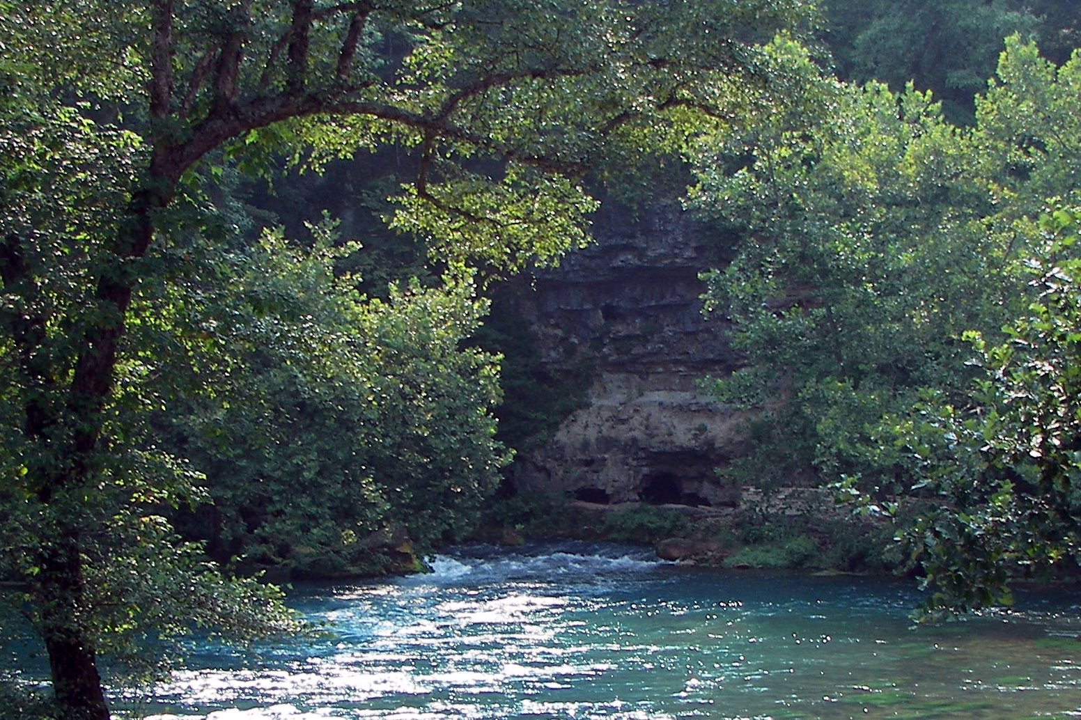
Hawaii is the only state in the United States that is made up entirely of islands. Honolulu is Hawaii's capital. The weather in Hawaii is warm and tropical. There are many beaches, active volcanoes, and it is surrounded by ocean waters. Hawaii attracts many tourists, such as surfers, biologist, and volcanologists. There are more than one million permanent residents along with visitors. The Hawaii's coastline is approximately 750 miles long. There are eight major islands in Hawaii. One is the Kaua'i island. It is the oldest of the eight islands of Hawaii. It was shaped by a single shield volcano about 5.5 million years ago. The Ni'ihau island is known as the "Forbidden Isle" and it is privately owned. The O'ahu island was formed by two volcanoes, the Waianae and Koolau. Approximately 80 percent of the state's population live in O'ahu. Moloka'i island is known as the "friendly isle." It's northern shore has the highest cliffs in the world which drops 3 thousand feet into the sea. Maui island was shaped 1.2 million years ago. There are  two volcanoes in the Maui island, the Pu'u Kukui and Haleakala. Lana'i is a company island. Many rich people either own a residence there or rent a great part of the island. Hawai'i is the "Big Island" and it is the youngest of all. It is bigger than all the islands combined. The island was shaped by five volcanoes.The last island is called Kaho'olawe and it is the smallest island in Hawaii. It is 11 miles long and 6.0 miles wide. 


Kauai Island


Chapter 19: California

California is a diverse state. Everywhere one goes, there is a lot to see. Los Angeles, San Francisco, San Jose, San Diego, and many cities are great to visit. Los Angeles is the second largest city in America. It is also one of the leader in America with green initiatives to cut greenhouse gas emissions. Los Angeles is a very diverse city. Most of it's radio and television shows are in Spanish. It is an automobile capital. Los Angeles is also well known for the motion picture industry. Most of the major studios are located in the area of Los Angeles. San Diego is ranked sixth largest city in the nation. It is very close to the Mexican border. Sea World is a famous amusement park and is located in San Diego. California's gold rush began in 1848 and ended in the early 1860s. San Francisco became the dominant city in California due to the gold rush.


Los Angeles is known to have a great number of homeless people. Living in California can be pretty expensive. Many people work long hours and may even work 7 days a week and might not afford everything they need. Also, there are plenty of people who work for the minimum pay or even less. It is hard to provide for a family nowadays. There are programs that help the homeless. Many volunteers help provide food and shelter for them.  


Chapter 17: Pacific Northwest

The Pacific Northwest is located between the Intermontane and the Pacific Ocean. It spans 2 thousand miles from Alaska Panhandle to northern California. There are three sub-regions in the Pacific Northwest: Washington and Oregon Coast Ranges, the British Columbia Coast Mountains; the Puget Sound Trough, Willamette Valley, and the Inside Passage; and the Cascade Mountains. The Coast Mountains rise 10 thousand feet above the ocean. The Puget Sound expands from the Inside Passage to Olympia, Washington. The Inside Passage is 800 miles long and it has been a route since 1897. The Cascade Range is 700 miles long and 50 miles wide. It expands from California to Canada. It's elevation is 3,000 to 9,000 feet.

Pacific Northwest

Portland, Oregon is located 70 miles east of the Pacific Ocean. It lies on top of an extinct Plio-Pleistocene volcanic field (Boring Lava Field). Portland is known for producing health. There is bicycle riding, hiking, local foods, healthy lifestyles, and green gardens. The weather in Portland is like temperate oceanic climate. In the summer it is warm and dry. The winter climate is mild. Portland's city park system is one of the best in America. Eighty percent of people who live in Portland live within a half mile distance from a park. The Portland Japanese Garden was designed by Takuma Tono who was a Japanese landscape architect. It was designed since 1963, but was opened to the public in 1967. It occupies five acres of the Washington Park.   


Chapter 16: Intermontane

Manifest Destiny

The manifest destiny, the belief that Anglo-Saxon American settlers were destined to expand their civilization and institutions across North America, was originated in the 1840s. Due to the expansion, there would be territorial gain and  progress of liberty and individual economic opportunities. John L. Sullivan was the first person to phrase the term. He believed that the manifest destiny goal was to overspread the continent. 


Mineral resources, such as coal, copper, and uranium can be found in the Intermontane. Copper is the most-mined resource. Chile is the largest producer of copper and the United States is the second. Producing about 25 percent of the nation's copper, Bingham, Utah has the single largest copper producer in the world. Coal can be found in the southern part of the Intermontane. The largest coal-mine is in Black Mesa, Arizona. Uranium was once considered a nuisance mineral found in goal. Uranium was discovered along the Ken River, which is about 30 miles northeast of Bakersfield, in 1954.       

Intermontane's population has been growing since the 1990s. Growth arises due to internal migration to warm climes by retirees. Also, growth occurs because young Midwestern Americans seek better jobs, better weather, and more active cities. Housing costs and racial issues have lead to internal migration. There are "islands" in the Intermontane. The "islands" are isolated cities that have access to water and amenities. They have access to jobs, retirement houses, and recreations.     


Sunday, December 1, 2013

Chapter 15: The Rocky Mountains

The Southern Rockies, Middle Rockies, Northern Rockies, Canadian Rockies, and the Brooks Range divide the Rocky Mountains. The Southern Rockies run from New Mexico to Colorado. The peaks in the Southern Rockies range from 6 thousand feet to more than 50 peaks over 14 thousand feet. The Middle Rockies contain the majestic Tetons and it transitions to the Northern Rockies. There is a national forest within the Northern Rockies. The Canadian Rockies runs across the interior ranges and the plateaus of British Columbia. The climate in the Rocky Mountains differentiate 35 degrees Fahrenheit from the Great Plains. Vertical zonation (distribution of organisms, vegetation, and soils by altitude) and latitude characterize the Rocky Mountains.

The Rocky Mountains

Tourism and recreation are two main contributors to the Rocky Mountains' economy. People love the view as well as the hiking and climbing. There are national parks, ski resorts, and Front Range cities. Tourism is good, but also bad. Although many people get to visit areas where local extractive economies have failed, too many events and people can damage the environment. California is also a tourist place. Many people visit Los Angeles, Sacramento, San Francisco, and other cities. Hollywood is one of the most famous places to visit in California. Also, many events are held there which brings many people. 


Chapter 14: The Great Plains and Canadian Prairie

Climate in the Great Plains is extreme, decidedly western, and dramatic. The Great Plains is different from the United States in four ways. The climate, precipitation, soil, and vegetation differentiate the Great Plains and the United States. In the Great Plains, land loses heat faster than water. The lands that are not as close to water bodies, are more extreme. The weather tends to be very cold in the winter and hot/windy in the summer. Because of the extreme weather on the Great Plains, there are thunder storms and hail that precede violent tornadoes.


Cowboys were people who lived in the Great Plains. They rode horseback and herded cattle. Cowboys became the American icon, although they were hired hands. They did not own the land, they worked it. The cowboy was a person who drove pickup trucks and lived in log cabin mansions. According to the Encyclopedia of the Great Plains, cowboys come from different backgrounds. Some grew up around the cattle and others became cowboys when they ran away from their home searching for a new life and jobs. A cowboy's hat became a symbol of the American West. 


Chapter 13: The Midwest


The population in the Midwest has been slow since 2010 due to the fact that many people move to the suburbia, outlaying rural areas, and other regions. Compared to the national growth, the Midwest only grew 3.9 percent in 2010. Minnesota and Indiana were the fastest-growing states in the Midwest. Minnesota's population grew 7.8 percent and Indiana grew 6.6 percent. On reason why the Midwest's population has decreased is because of employment loss in the sectors as well as jobs moving to more amenities-based southern climates. Another contributor to the slow population growth is that the out-migration is much higher than the immigration in the Midwest. 


California is one of the fastest-growing states in the nation. According to Public Policy Institute of California, California is one and a half times as populated as Texas (the second most populated state). There are over 37 million people living in California. Although California's population slowed in the last half of the 20th century, it has tripled and has maintained a growth rate much higher than the rest of the United States. California's population is one of the most diverse in the world. About 10 million of its population are immigrants.     
   

Chapter 12: The Ozarks

The Ozark Plateau, also known as the Central Plateau, controls the southern half of Missouri and extends to the northern Arkansas. Its landscape is a mixture of unusual topographic features. There are shut-ins, rivers confined in a deep, narrow, water-sculpted gorge or channels, carved in the hard rocks. There are also balds which are bare mountaintops. The Ozark Plateau and the Arkansas River Valley are separated by the Ouachita and Boston mountains. Its main resource is located in the Courtois Hills where there is timber.

   The Ozarks

The term Hillbilly, a person from the backwoods or a remote mountain area, was used in the Ozarks. Hillbillies were people who were not familiar with office politics nor new models. A hillbilly had the opportunity to get closer to his God and was honest. Although most of the people who live in the Ozarks are not hillbillies, there is a stereotype about them. Hillbilly music has evolved form the Celtic and English folk songs. Nowadays, people who live a hillbilly lifestyle do so because they choose to, not because of the location where they live. 


Saturday, November 30, 2013

Chapter 11: Gulf Coastal Plains and Mississippi Valley

The Mississippi River

The Mississippi River is the largest drainage system in North America. It is ranked the fourth longest as well as the tenth largest in the world. The basin covers more than 1,245,000 square miles. According to Chris Mayda, "the river shifts some of its channels ten to twenty times a century as it courses at four miles per hour, ninety-six miles per day." The river is divided into three sections. There is the Upper Mississippi, the Middle Mississippi, and the Lower Mississippi. The Upper Mississippi runs its headwaters to its confluence with the Missouri River in St. Louis, Missouri. The Middle Mississippi runs from the St. Louis to the Ohio River. The Lower Mississippi runs from the Ohio River to the mouth of the Gulf of Mexico. 

Sacramento River

The Sacramento River is the most important river in Northern and Central California in the United States. It drains an area of about 27,500 square miles. The Sacramento River provided a transportation route for the first people who settled more than 12,000 years ago. Gabriel Moraga, an early explorer, named the river, Rio de los Sacramentos. Like the Mississippi, the Sacramento River splits into sections. One is called the Upper Sacramento and the other is called the Pit.  

Friday, October 11, 2013

Chapter 10: Florida


It is interesting to know that Florida used to be part of North Africa. How is this possible? Due to level shifts caused by climate change, the peninsular part of the state broke off of Africa. It is predicted that by the year of 2100, Florida could be underwater. Florida's weather is tropical like the Caribbean. Florida has attracted many tourist because of its location and weather. Southern Florida's weather tends to be between seventies and eighties. The North part is more cold.

As aforementioned, Florida has many tourist. Tourism and retirees are big contributors of Florida's economy. There are approximately 80 million tourist per year. It is estimated that the tourist industry pays a large part of Florida's taxes because the tourism industry brings in about 57 billion dollars per year. People love the weather and many attractions that Florida has to offer. Just like Florida, Hollywood too attracts a lot of tourists. Hollywood has millions of tourists per year. They enjoy the nice weather and hope to see their favorite stars. There are also other tourist attractions such as, Disneyland, Universal Studios Hollywood, Knott's Berry Farm, Six Flags Magic Mountain, and many more.


Chapter 9: South Atlantic

The term redneck and cracker has been used for many years and both terms originated from the South. Rednecks were white poor people who lived in the South. They usually worked as a yeoman farmer who were previously servants. Now in the united States rednecks are referred to white underclass people. The term cracker was used for people who were considered "white trash." These people are those who did not have an education and who practiced cracking. Nowadays, these terms are still used. Many people know what these terms really mean, but there are others who use them as racist terms. It is common to hear someone call a very white person redneck because of his/her physical appearance. California is a diverse state and it is not unusual to see people who physically look redneck.


Cotton was important in the South. There were two types of cottons that were grown in the South. One of them was called the Seal Island which was easier to clean and it was imported from the West Indies. Upland cotton was more difficult to clean and was grown in the land. Cotton was ranked third in production. Cotton is also grown in San Joaquin, California. San Joaquin has a valley cotton tour that attracts many consumers. According to the Western Farm Press, the annual tours that are arranged bring farmers, brokers, supply chain partners, and brands so they can get an idea of the challenges and possibilities of making changes in the cotton industry. 

San Joaquin Valley Cotton Tour


Chapter 8: Appalachia

Catskill Mountain 

The Appalachian Plateau is very large that it expands from Tug Hill to northern Alabama. Its elevation is about 1,000 feet to 3,000 feet. The Appalachian Plateau's highest mountains is the Catskills which is 4,000 feet high. The California Plateau rises to 10,000 feet on the eastern side.

Coal in the Appalachia has supplied a lot of electricity for America. People are very dependent of coal. Although there are great benefits, coal causes a lot of air pollution, acid rain, deforestation, and degradation of soil. Strip mining, was a type of mining method in the Appalachian Plateau. It was done by stripping rocks and soil from the top of the surface in order to get the coal from beneath the surface. According to Dan L. Mosier, writer of Tesla, the first commercial coal mine in California was the Coast Range. The Coast Range coal mine shipped coal to fuel-hungry factories in Stockton. It sold about 60 tons of coal. Although the Coast Range coal mine did not last long, in 1868 a group of Welsh miners opened Commercial coal mine. The most successful coal mine in California was the Tesla coal mine. This mine was opened by John Treadwell and he also organized the San Francisco and San Joaquin Coal Company. The Tesla mine produced more than 80,000 tons of coal per year.

Tesla Coal Mine 
           

Chapter 7: Megalopolis

When thinking about megalopolis, Los Angeles comes to mind. Los Angeles is a very large city containing a population of approximately 4 million people. Like New York, Los Angeles is a big city where it seems like people never sleep. Throughout the day, no matter what the time, there are people out in the streets going from one place to another. Both places have a large population which means that there is a lot going on. New York City has a transportation network which expands more miles than the actual city. New York's metropolitan expands for many miles that it reaches to other states. Los Angeles metropolitan area is the 2nd largest metropolitan area in the United States and the 13th largest metropolitan in the world. Los Angeles is known as the Entertainment Capital of the World, therefore it is a very popular area. Tourist come and go all the time. Since there is so much going on in the area, there are many different transportation. There is even a metro rail that takes people around from five in the morning to midnight all seven days of the week.

New York City

Los Angeles
    

Chapter 6: The Northern Atlantic Provinces and Northern New England

In the Northern New England, settlers focused on farming crops such as, blueberries and potatoes. In California people also grow crops. Agriculture is a huge contributor for the California economy. Since the last three decades, farming sales in California have quadrupled. For example, the San Diego agriculture is placed fourth on the county. San Diego's agriculture is productive because of the climate, water, and soil that is in San Diego.

   San Diego Agriculture

According to Bettey Sutton, from Lone Star College in Kingwood, during the Great Depression many people had lost hope because what was the land of opportunity was now a land of depression. American families' income had reduced from $2,300 to $1,500. Many people hoped to find some place where they could get back on track. Many families decide to move to California and start working in the agriculture fields. 

There are many crops grown in California. According to BeachCalifornia.com, California's number one products are milk and cream. The number one nation's dairy state is California. Also, California is known to grow some of the best grapes. California's grown products also include almonds, olives, raisins, walnuts, and many more. For the past fifty years, California has been the number one food and agriculture producer in the United States. 


Thursday, October 10, 2013

Chapter 4: Population and Consumption

California is known to be one of the most diverse states. The population in 2012 was 38,041,430. In just ten years, California's had an increased of 3,090,016. These numbers are pretty high and it would be higher if people would have not migrated to Texas, Nevada, and Arizona in 1990. Los Angeles county has a greater population than 42 U.S states and it held title for the most populated county in the U.S for decades. Also, as mentioned earlier on another chapter, California's top eight most populated cities in the United States include; Los Angeles, San Diego, Long Beach, Oakland, San Jose, San Francisco, Fresno, and Sacramento.

Although California is a diverse state, the majority of its population is made up of California born residents. Many illegal immigrants contributed to the large amount of population, but since there has been an increase in security at the borders less people have tried crossing to United States. California has the most minority populated group in the United States. About 60% of California's population is made up of minority groups.

According to the pie graph below, in 2000 people between the ages of 25 and 44 made up 31% of California's population. Next, with 23% of population were teenagers and young children ranging from 15 years and younger. People who were 45-64 years old made up 21% of the population. Teenagers and young adults (15-24 years) made up 14% and the elderly (65 and older) made up only 11% of California's population. 


Chapter 3: Sustainability

California is a large state which means that there are a lot of people who live in the state. Because there is so many people, energy us used a lot. California has promoted people to reuse energy. By 2020, California hopes to obtain a third of its electricity from renewable products. A lot of products that people use in their daily lives can be transformed into reusable items.  


California aims toward a sustainable future. Solar panels have been promoted in many places to maximize the conversion of sunlight into electricity. Installing solar panels helps conserve energy, it is inexpensive, and it is a natural way of using electricity. People are contributing to global warming by leaving lights on or even turning them on during the day. Solar panels help produce clean and renewable energy. The picture below is the 354 MW SEGS concentrated solar power which is the world's largest solar plant. 


California also has two major nuclear power plants known as the Diablo Canyon and San Onofre. The Diablo Canyon power plant is located in Avila Beach and is now the only nuclear plant that is operating due to the shutdown of San Onofre in 2013. This nuclear plant produces 18,000 kilowatt-hour of electricity per year. It is about 750 acres.   


Diablo Canyon Power Plant


Chapter 2: The Nonhuman World

The Sacramento River

The Sacramento River and the San Joaquin River are California's most known rivers. Most of California's rivers are dammed as part of the Central Valley Project, planned in 1933 to regulate and store water to the agriculture in Central Valley, and the California State Water Project, which provides water for 23 million people. Another river in California is the Mojave River. The Mojave River is an underground river which means that most of the time its surface is dry. The Santa Ana River is Southern California's largest river. It is 96 miles long, rising in the San Bernardino Mountains flowing past San Bernardino and Riverside, and it drains about 2,650 square miles. 

Mojave River

Santa Ana River

One of the reasons why many people love California is because of the great weather. The weather is cool, rainy, and dry. It has a Mediterranean weather like. During the summer, it gets pretty hot in the valley and fogs form near the coast. California's highest temperature was 134 degrees Fahrenheit in July 1913 and the lowest was -45 degrees Fahrenheit in 1937. The climate can be influenced by the mountains. During the winter the mountains are covered in snow and during the summer the weather ranges from mild to moderate heat. 

Many people enjoy the summer time in California. The weather ranges from about 90 to a little over 100 degrees Fahrenheit. People love going to the beach to enjoy the hot sun and cold water. People love getting tans and playing games on the sand. Day time is not the only time people decide to go to the beach to cool off, nighttime is an even better time to visit the beach during the summer. 


Malibu Beach 

Wednesday, October 9, 2013

Chapter 1: Regions and Ecoregions: An Approach to Sustainable Geography


California is located in the West Coast of the United States. California originated from the region composed of the Baja California peninsula. California has the third longest coastline and has the highest and lowest point in the 48 adjoining United States' states. It's capital is Sacramento and eight of fifth cities, which are the most populated cities are in California (Los Angeles, San Diego, San Francisco, San Jose, Fresno, Sacramento Oakland, and Long Beach). Oregon, Nevada, and Arizona surround California. 


There are a lot of regions in California such as, Antelope Valley, Central Valley, Lake Tahoe, San Francisco Bay Area, Sierra Nevada, and many more. California has many endangered ecological communities. It is also part of the Nearctic ecozone, one of the eight terrestial ecozones that divide Earth's surface, and it is one of the richest diverse parts of the world. California's ecoregions are divided into the following: deserts, Mediterranean, forested mountains, and coastal forests.